Carter Caves State Park Box Canyon Trail
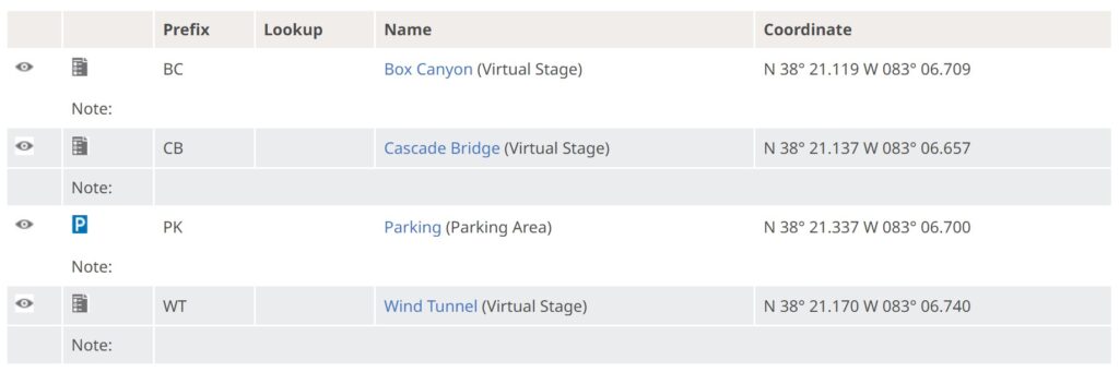
Parking N 38° 21.337 W 083° 06.700
THANK YOU Chris Perry (Park Manager) and Robert Myers (State Park Naturalist) for permission to share this learning adventure.
THANK YOU Cav Scout, Platinum Earthcache Master for discovering and sharing this location.
THANK YOU LN for helping RT negotiate this challenging terrain.
THE TRAIL … Box Canyon Trail, and is one of the most scenic trails in the park. It is a .75 mile loop trail beginning at the Cascade Caves parking lot, proceeding to the head of Box Canyon, and looping back to the parking area.
THE VALLEY … Most of the valley floor in this canyon is underlain by the Slade Formation. Box Canyon valley is largely a dry bed, because most of the drainage enters the subsurface through the many sinks. Only during major storms would we see any streamflow, You will encounter vertical walls of sandstone known as Carter Caves Sandstone. This sandstone represents a tidal-channel deposit that formed in Late Mississippian time when the area was dominated by extensive tidal currents. The sandstone walls are over 100′ thick.
ROCK TYPES IN THE CANYON … The rocks you will see along the trail are sandstone (gritty), shale (smooth), and conglomerate (rounded pebbles). The difference in colors is due to the minerals present.

BOX CANYON … N 38° 21.119 W 083° 06.709 / https://coord.info/GC8FGE2
A massive joint is responsible for the formation of this valley. The canyon is a northwest–southeast-oriented karst solution valley or uvala that probably formed from a large, collapsed trunk cave. As you hike the trail, evidence of this is shown by the sink holes dotting the valley floor and the caves within the walls. Erosion of overlying sands, shales, and limestones resulted in the exposure of the Carter Caves sandstone and the massive cliffs you see. Much of the sandstone roof has now been destroyed by erosion and collapse in the karst solution valleys or uvalas. The steep walls of the canyon are over 60 ft high. The square corners result from collapse of the sandstone along two sets of intersecting joints, at a nearly perfect 90° angle.
1. WALLS … a. How high are the walls? / b. What is the angle of intersection? … a. 60′ / b. 90°
2 COLORS … a. What are the colors on the cliff walls? / b. What causes the colors? / c. Is there a difference in texture between the colors? … a. Predominantly reds and yellows / b. different minerals / c. Gritty sandstone texture throughout
REVIEWER NOTE … What is the significance/cause of the observed colors? It seems there could be an interesting earth science lesson around which minerals cause which colors when exposed to air and water.
3. Why do you think this is called a box canyon? … Opening only on one end with smooth, high walls, intersecting at nearly right angles.
CASCADE BRIDGE … N 38° 21.137 W 083° 06.657 / https://coord.info/GC8FA4D
“This structure is not really a bridge or an arch, as it is closed off on one side. This is a collapse alcove that formed by collapse of the sandstone as supporting limestones were dissolved from under the sandstone. This “bridge” or alcove in part reflects the influence of joints in the area. The vertical surface behind the alcove, as well as the flat surface of the sandstone wall defining the head of this valley, are large vertical joints, along which weathering has proceeded.” The sides of this bridge are very straight because the bridge formed between two parallel fractures at the top of the ridge.
QUESTIONS … There are large tubes emerging from the edge of the arch. These formed when embedded rock was twisted by the movement of earth’s tectonic plates. … a. Location of the tubes? / b. What is the average length of the tubes? / c. What is the average diameter of the tubes? / d. What is the composition of the tubes?
REVIEWER NOTE … What is the significance of the tubes? Was there a unique mechanism that formed them or was it a variation in how the original substrate was laid down or both?
ANSWERS … a. Right hand edge of the arch / b. several feet / c. few inches / d. sandstone
WIND TUNNEL … N 38° 21.170 W 083° 06.740 / https://coord.info/GC8FGE7
The movement of Earth’s tectonic plates caused cracks (vertical joints) in the sandstone.
The tunnel began as one of these cracks in the sandstone cliff.
Erosion via wind and water enlarged the opening you are now walking through.
QUESTIONS … a. How was wind tunnel formed? / b. As you walk through the tunnel, how much room is between the walls and your shoulders? / c. When you emerge from the tunnel, what do you see? / d. Why do you think it was named wind tunnel?
ANSWERS …a. Formed from a vertical joint and enlarged by erosion. / b, Narrow with shoulders nearly touching walls. / c. Open area with cliff walls surrounding you. / d. You can hear the wind whistling through the tunnel.
LIESEGANG BANDS
These are formed by the dissolution of iron compounds and their rhythmic precipitation as bands in the sandstone.
REVIEWER NOTE … Recommend expanding the explanation of “liesegang bands” so visiting cachers know what they are looking for.
DISCOVERY … As you walk the trail, find an example of Liesegang Bands. Take a pic -and- Identify the location either by coordinates, or reference to the waypoints (example between between Cascade Bridge and Box Canyon). There are multiple examples along the trail.
WEATHERING
Weathering is the breaking down of rock into smaller fragments. All rock weathers over time. Grains of sediment fall out. Cracks develop on the surface and deep inside. Weathering causes rocks to fracture, buckle, and crumble into soil and sediment. Mechanical Weathering breaks apart rocks without changing their chemical composition. Each fragment and particle weathered away by a mechanical process retains the same characteristics as the original rock. Mechanical weathering can be caused by growing plants, flowing/falling water, wind, expanding ice, lightning, and expansion and contraction with heating and cooling. These physical processes create enough force to break rocks into smaller pieces. Chemical Weathering occurs when water, air, and other substances react with the minerals in rock. In chemical weathering, the composition of the rock changes. Many descriptive names are given to the Forms of Weathering such as boxwork, cavernous, alveolar, stone lattice, beerock, honeycomb, talfoni, and root wedging.
DISCOVERY … As you walk the trail, find two different types of Weathering. Take a pic -and- Identify them (example boxwork and root wedging). There are multiple examples along the trail.
RESOURCES … Geology Tour